This blog page was started 12:20 PM, Dec 28, 2006.
Jump to a particular update:
- 12:20 PM, Thursday, Dec 28, 2006
Anticipation.
- 6:55 PM, Thursday, Dec 28, 2006
The storm begins!
- 8:55 PM, Thursday, Dec 28, 2006
Meteorology of the storm.
- 9:30 PM, Thursday, Dec 28, 2006
Traffic comes to a standstill.
- 10:30 PM, Thursday, Dec 28, 2006
7.7" of new snow!
- 11:30 PM, Thursday, Dec 28, 2006
Pictures posted!
- Noon, Friday, Dec 29, 2006 The calm before round 2
. . . or the end of the storm?
- 4:30 PM, Friday, Dec 29, 2006
The Big Calm continues, here are some snow totals.
- 9:00 PM, Friday, Dec 29, 2006
More pictures posted.
- 10:00 PM, Thursday, Jan 4, 2007
Final storm wrapup, snow maps, and some pictures from Saturday, Dec 30.
Posted 12:20 PM,
Thursday, Dec 28, 2006
Just a few minutes ago, the first snowflakes of the newest
storm began to fall. If the National Weather Service's predictions are correct,
this storm could be epic - maybe becoming one of the Top 10 largest snowfalls in
Fort Collins history. Amazingly, this storm comes on the heels of last week's
holiday blizzard which dumped 19.7" of snow on the city! A storm of that size is
fairly rare in Fort Collins, but to have two storms of this size in just over a
week apart may be unprecedented. The numerical weather prediction models have
been all over the place with their predictions, but if even the moderate
scenarios verify, we could be looking at 15-20" by the time everything wraps up.
If the most extreme scenario occurs (basically a snowy version of Armageddon),
Fort Collins might end up with 30" or more! This is hard to believe, and while
there are still many uncertainties, it seems a sure bet that we will get at
least 10" from this new storm and probably more like 15-20".
So how much is really predicted? The text of the latest
Winter Storm Warning is calling for Fort Collins to get 10-18" for the first
round of the storm ending Friday morning, then mentions the possibility of
10-20" more snow for Friday night and Saturday! The gridpoint forecast issued at
11:32 AM gives Fort Collins a total of 20": about 2" by 5 PM this afternoon, 8"
overnight, about 4" during the day on Friday (a big break is expected on Friday
while the storm reorganizes and cranks up over OK/NM/TX), then another round is
supposed to come in Friday night with 4" by noon on Saturday. About this time,
the winds are forecast to become quite strong with gusts to 45 mph possible.
This along with another 2" of snow Saturday afternoon and evening should bring
true blizzard conditions to the area.
Hourly Weather Point Forecast for Fort Collins, CO from
the National Weather Service
Looking at the NWP models, if the 12Z run of the WRF-NMM
(North America Model) is correct, the heaviest snow will be tonight and then we
will just have nuisance snow on Saturday and maybe snowshowers on Sunday
(although farther east, the backlash may give heavy snow to NE Colorado even on
Sunday night). This model did very well during the last storm, so it is tempting
to buy it's forecast this time as well. I think the GFS has also backed off from
yesterday's craziness (for a few runs, the models were leaning towards the
extreme scenarios). I think that the 2nd wave of the storm may not be as bad as
predicted, but I could certainly be wrong. My best guess is that we'll see a
total of 17" of measurable snow when all is said and done. We shall see .
.
Are we ready for this? Not really - snow removal from the
last storm has been rather difficult or downright frustrating depending on where
you live. Last week's storm was enough to overwhelm the resources and manpower
that the city keeps on hand for these types of events - while the main arterials
have been cleared and are in good shape, many residential streets have barely
been touched or just been passed through once with a plow. Some of these streets
have huge humps where the snow has been compacted and turned into sheets of ice.
The past week saw several days of surprisingly warm and sunny weather, so the
neighborhood streets have improved a lot - but there is hardly any place to put
any new snow. All the places which were convenient to pile snow have already
been piled high! So this next storm could absolutely paralyze the city.
Thankfully, CSU is on holiday and overall traffic in town is quite light. But
time will tell. I'm guessing that if we get the low end of the predicted amounts
(10"?), the city will be able to return to normal fairly rapidly. If we get the
NWS-predicted amount of 18", we are going to be in bad shape. If the apocalyptic
scenario occurs, there is going to be weeping and gnashing of teeth! The city
will be in dire straights for days. In the past couple days, I've seen a renewed
sense of urgency - a lot of heavy equipment including road graders are out on
the streets trying to make room for the new snow. I'm sure the city's snow
removal crews are already exhausted.
That's all for now. I'm going into work now to collect
about a week's worth of papers to read (I'm hoping for the apocalyptic
scenario), put snow cables on my car, and maybe stop by the grocery store. Then
I'm just going to hunker down and enjoy the storm :) I'll probably write
another update tonight as the heavy snow begins.
Posted 6:55 PM,
Thursday, Dec 28, 2006
The storm has begun! By 10:00 this morning, clouds were
lowering and it looked like it might already be snowing in the Foothills. During
the day, the clouds lowered further and became more nondescript - this often
happens as the upslope flow sets up. The temperature had warmed close to 40 degF
so when the precip started falling at around 2 PM, it was rain! It hardly ever
rains in Fort Collins in the wintertime. It was very light, more like a drizzle.
At 4:30 PM the rain changed to snow as a heavy band on the radar moved in from
the east. By the time I left work at 5:30, it was snowing heavily and the roads
were already extremely slick. I was the second to last to leave from my
department, so the parking lot was wide open! Needless to say, I had some fun
doing doughnuts. I'm not sure I've ever done them properly before - anyway, it
was a total blast! As I drove the 4 miles back, I saw the results of a traffic
accident near the King Soopers on West Elizabeth. The mayhem has begun.
I am a volunteer snow spotter for the National Weather
Service. At 5:55 PM I sent in my first report for this storm:
New snow: 1.0", storm total: 1.0", snowdepth: 12.0".
Snow began at 4:30 PM. Current weather: heavy snow, 32 degF, winds gusting to 15
mph. Secondary roads already very slick. Because of the previous rain, snow is
sticking to tree branches.
Here is what other observers have reported around the Front Range:
Latest Snowfall Totals in Northeast Colorado from the Boulder National
Weather Service
The snow began quite a bit earlier down in Denver this afternoon. Some
locations in the Foothills have already received 10" with snow rates of 2" per
hour! Fort Collins has just 1" . . . Things have really picked up though and the
radar shows a solid heavy band has filled and is just hammering the Front Range.
It looks like the storm is well underway.
Radar composite from the UCAR-RAP Weather Page for 6:58 PM
MST, 12/28/2006. This is about the peak of the storm for Fort Collins.
I subscribe to the Larimer County emergency e-mail list, and
this afternoon they sent out the following somewhat ominous e-mail:
The following information update has been made for:
Winter Storm
Issued at: 5:19 AM MST 12/28/06, expires at: 1:30 PM
MST 12/28/06 Winter storm warning remains in effect from noon today to 6 am mst
Friday, winter storm watch in effect from Friday morning through late Saturday
night,
Snow will develop late this afternoon and will be
heavy at times tonight with new snow accumulations of 8 to 18 inches possible by
late tonight. North winds at 15 to 25 mph will create areas of blowing and
drifting snow overnight.
There is a potential for additional heavy snowfall
again, along with strong winds, especially from Friday night into early Sunday
morning. Snowfall amounts during that period could total 10 to 20 inches.
Blizzard conditions are possible. Stay tuned to the national weather service and
your local news media for the latest updates concerning the heavy snow potential
over the weekend.
This is a storm we need to take seriously and
perhaps the best thing you can do is just hunker down this weekend and not plan
on going anywhere. Many of us won't be able to anyway if this forecast holds up.
If you only have a day's worth of food in the house, you might want to stock up
this afternoon although many shortages were evident in the area grocery stores
even on Wednesday. An don't even think about trying to buy a snow shovel. There
are none to be had for the present. Remember -if you lose power/heat, DO NOT
utilize an open flame heat source inside your home like a kerosene heater or gas
grill without complete ventilation (better yet, just don't use them period). The
danger of carbon monoxide poisoning is very real and very deadly. If you
received (and kept) one of the Larimer County Emergency Preparedness Guides
which the Sheriff's Office sent to thousands of County residents, please take
time to review issues like the page on severe winter storm and the "72 Hour
Kit". After this storm has come and gone and you want one of those guides, feel
free to drop by the Sheriff's Office at 2501 Midpoint Drive for a free copy or
copies. We will hope that more normal winter weather returns immediately after
this storm has run it's course. It's nice to have the moisture (under the
circumstances, that sounds like an irritating cliche') but we will probably all
be glad when this melts and we have a good old fashioned January thaw. Hang in
there folks, try to avoid cabin fever and be patient.
I especially like the line "An (sic) don't even think
about buying a snow shovel." The point about being prepared with at least 72
hours of food is a very good point. Everyone should always keep extra food on
hand - when disaster strikes, you're often on your own. Your survival in a
disaster situation depends on your own preparation and actions.
The latest NWS gridpoint forecast now predicts the
following snow amounts: 6" overnight, 4" through Saturday midnight (the lull),
then 3" on Saturday. The Winter Storm Watch for the second wave has now been
extended through Sunday! But the second piece of the storm is supposed to be
heaviest out on the plains with 6-12" possible. So adding that all up, it looks
like Fort Collins is on track to get about 15" for the whole storm.
Posted 8:55 PM,
Thursday, Dec 28, 2006
The snowstorm is going gangbusters - we're
probably now in the middle of the first heavy snow period which should start
tapering off early tomorrow morning. During the last three hours it has snowed
steadily and heavily - at least an inch per hour, sometimes 2" per hour.
In this update, I'll focus on some of the meteorological
parameters contributing to this heavy snowstorm.
[Picture lost due to my ineptitude - I accidentally
hot-linked instead of putting the actual image here, so it's gone.]
This first map (all of the following maps in this section are
from the UCAR-RAP Weather Page) shows the upper level weather chart at 700 mb
(about 10,000 feet). Actually, this is not the actual data, but the analysis of
a short-term model - but it is pretty close to being the real thing. It shows
that the very large storm system has closed off and is currently centered a
little south of the Four Corners area. The circulation around this low is
bringing up very warm, moist air from the Gulf of Mexico, throough TX and around
into Colorado.
[Picture lost.]
Here is the same type of map, but for 500 mb (roughly 18,000
feet). The 500 mb low is centered over the NM-AZ border and is quite broad.
Normally for the ideal Fort Collins snowstorm, the low should be over the Four
Corners area - but in this case, the low is so large that it appears we are
still in a prime area to get strong upslope flow. But this may be more ideal for
a heavy Denver snow event.
Here is the current surface plot at 8:33 PM MST, Dec 28, 2006.
Strong northerly winds are developing to our north, but our local surface winds
have a bit of an easterly component - this is good for continued heavy snow. If
the winds went even further easterly, it would be even better. Northerly winds
in our area normally descend more than a 1000 feet as they come of the Cheyenne
Ridge - this tends to dry the air out and warm it up, reducing our snow. So far
this hasn't been a big factor yet. But a so-called barrier jet of northerlies
right near the surface can actually increase snowfall in certain situations -
this is because the moist, easterly flow hits this band of low-level northerly
winds and is forced to rise even before it gets to the mountains - this means
that heavy snow falls further east than it might normally fall.
[Picture lost.]
This is a plot from the Platteville wind profiler which is
about 30 miles southeast of Fort Collins. Wind profilers sense the wind strength
and direction from near the surface up to near the top of the troposphere (the
part of the atmosphere where nearly all weather happens). So this plot shows the
winds through the depth of the troposphere (to 12 km) vs. time (bottom axis).
The leftmost data are the most recent (8 PM MST, Dec 28, 2006). The direction is
indicated by the wind barb (it points in the direction the winds are coming
from). So you can see that in the lower part of the atmosphere the winds have
become strong out of the east, but right at the surface, they are northerly. The
speed is indicated by the number of barbs (10 kt for every full barb, 50 kt for
a flag). So we have deep upslope throughout the atmosphere all the way up to 5
km (18,000 feet). Since this air is very moist and the winds are blowing it
right towards the mountains, this is VERY good for heavy snow.
[Picture lost.]
The 5 PM MST Denver sounding also shows the deep upslope
developing. It also shows that the atmosphere is nearly saturated all the way up
above 300 mb (that's about 30,000 feet).
Winter Weather
Preparedness Guide Do you know what to do if caught in a
winter storm? Check out this interesting 11-page brochure.
Okay, that's enough for now. I'm going to go outside and make
one last measurement for the evening. Before I go to bed, I plan to post some
pictures from the storm so far - look for these in about an hour.
Posted 9:30 PM,
Thursday, Dec 28, 2006
The region's transportation is coming to a
halt. Media reports I-70 traffic has come to a standstill and I-70 at Floyd Hill
has now been closed. It was already a mess earlier today up near the Eisenhower
Tunnel when accidents caused a temporary closure. It reopened this afternoon,
but the heavy snow has continued in the Foothills (with close to 20" in a few
areas). Now it looks like accidents have brought traffic to a standstill in
Idaho Springs. With heavy snow continuing, this means that plows can't plow the
road (since it is filled with a traffic jam). Needless to say, the prognosis
doesn't look good. I-25 is now closed between Wellington and Cheyenne - a
notorious section of road in winter conditions. Also I-80 is closed between
Laramie and Cheyenne, and other major routes like US-287 are now closed.
But - Denver International Airport is still
open - mindful of all the media coverage of the thousands of stranded travelers
from the previous storm, the city is making a Herculean effort to keep the
airport open. It helps that this storm has weaker winds (so far) and that the
snow is stickier, so it is not blowing as much. My brother-in-law is supposed to
fly through on his way to Montana tomorrow, so it will be interesting to see if
the airport is still open by then. United has already canceled 120 flights, and
Frontier has canceled 100 flights.
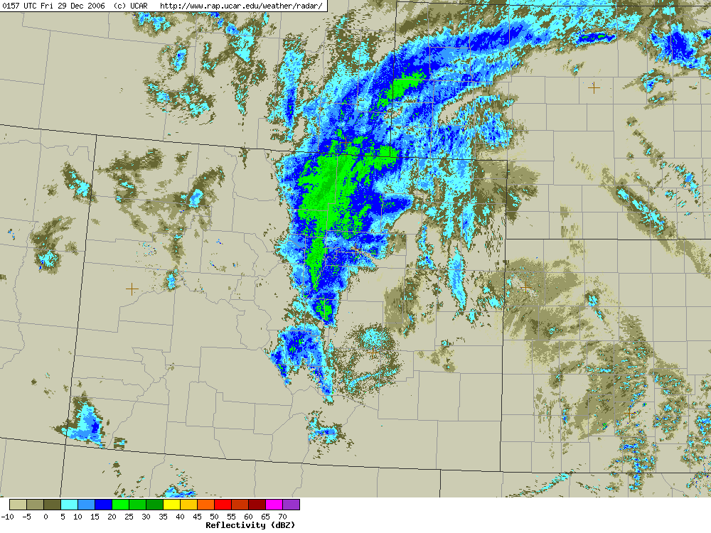
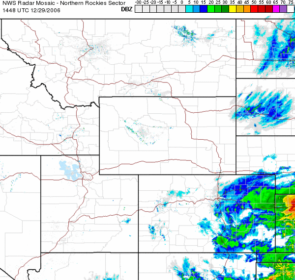
Here is an update radar composite as of 9:48 PM MST, Dec 28,
2006. The heavy snow area is still anchored solidly over Fort Collins and areas
west of I-25, but it is not looking nearly as solid to the east. This may
indicate that the first break is coming in a few hours. But a large area of
heavy precipitation is blossoming down in TX and moving northward. It will be
interesting to see what happens with this - the short range RUC model seems to
indicate that most of this moisture will NOT make it this far north, but rather
will circulate around closer to the low center. The low still has to cross the
NM mountains and then reorganize, so it is not completely certain how the storm
will evolve at this point.
Posted
10:30 PM, Thursday, Dec 28, 2006
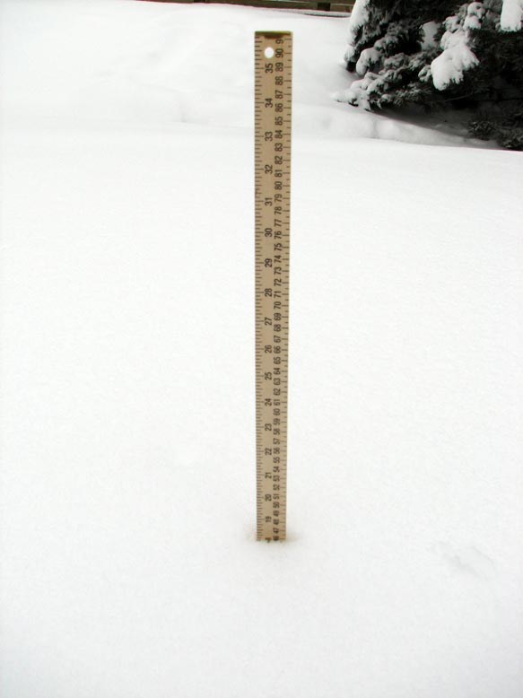
Here is my 2nd snow spotter report of the evening (made at 10:05
PM):
New snow (in past 4h15m): 6.7", storm
total: 7.7", snowdepth 18". Current weather: 27 degF, heavy snow, winds gusting
to 15 mph. Absolute winter wonderland - snow has stuck to every sprig and
branch.
Of exceptional note, we are about to eclipse the maximum
snowdepth from last week's storm which was 19" - this was apparently the 2nd
greatest snowdepth on record since 1949. This morning, before the storm began, I
measured a snowdepth of 11-14" in the I-House backyard (which is somewhat
protected and shaded) and 9-12" in the front yard. For the specific area I'm
measuring snowdepth at, as the storm began we were at 12". Now we're up to 18"
and the snow is still going strong. If we surpass 23", this *might* be the
all-time record snowdepth (at least as far as I can tell from the data I have -
it may be spotty and missing previous large storms though). The 23" snowdepth
was the official maximum set during the 2003 March Snowstorm (unofficially I
measured 27" in the I-House backyard, but again this is a somewhat protected
area so it might collect a bit more snow than an open field would).
Posted 11:30 PM,
Thursday, Dec 28, 2006
Okay, the exciting part of the storm is about done. I
think the heavy band over Fort Collins will probably break up and taper off in
the next few hours. So I am going to bed now. Here are the pictures I've taken
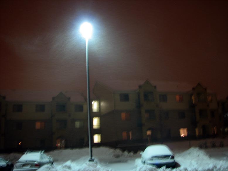
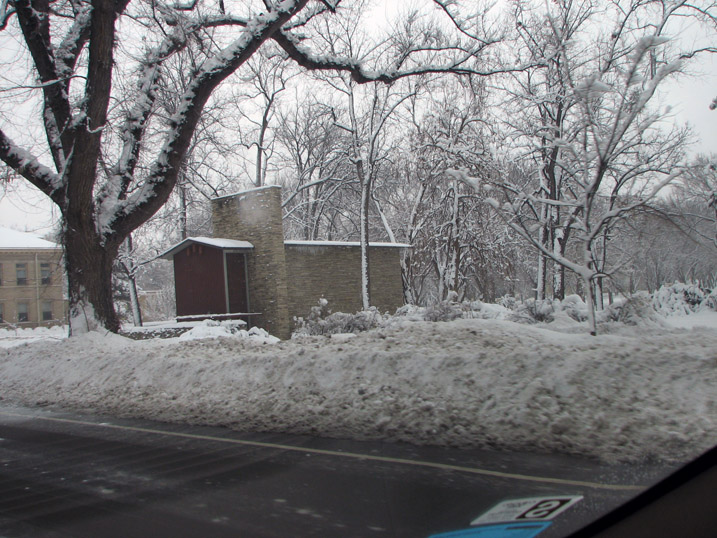
of the storm so far.
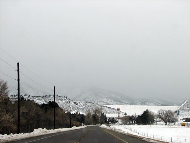
The view from Laporte Avenue at 2:36 PM. Snow has begun over
the Foothills.
Here is the view from my office at the Department of
Atmospheric Science building at 4:22 PM. The snow has now begun at the lower
levels.
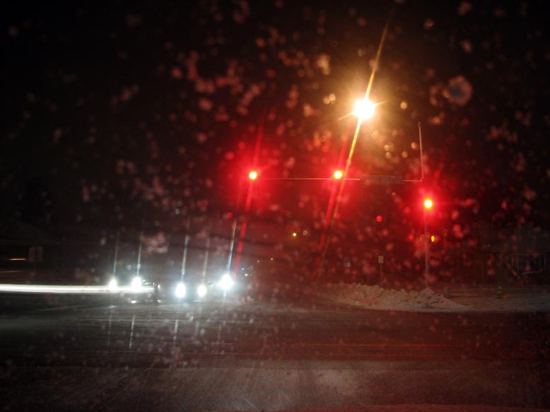
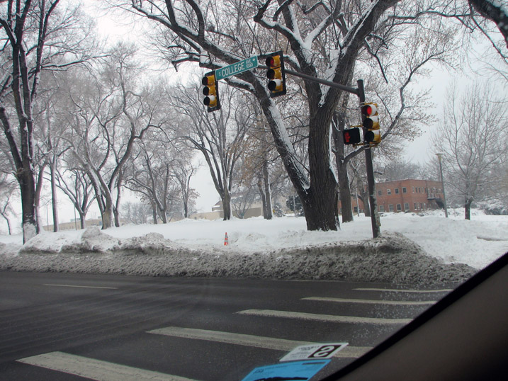
This is the Taft Hill/West Elizabeth intersection at 5:52 PM.
The roads are already quite treacherous by now.
Here are some pictures taken in the the International House
parking a few minutes later.
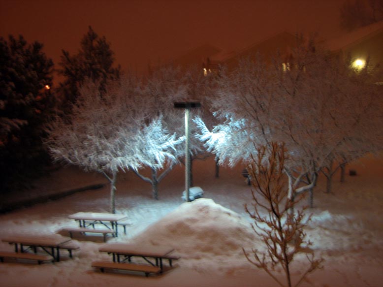
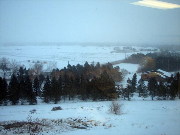
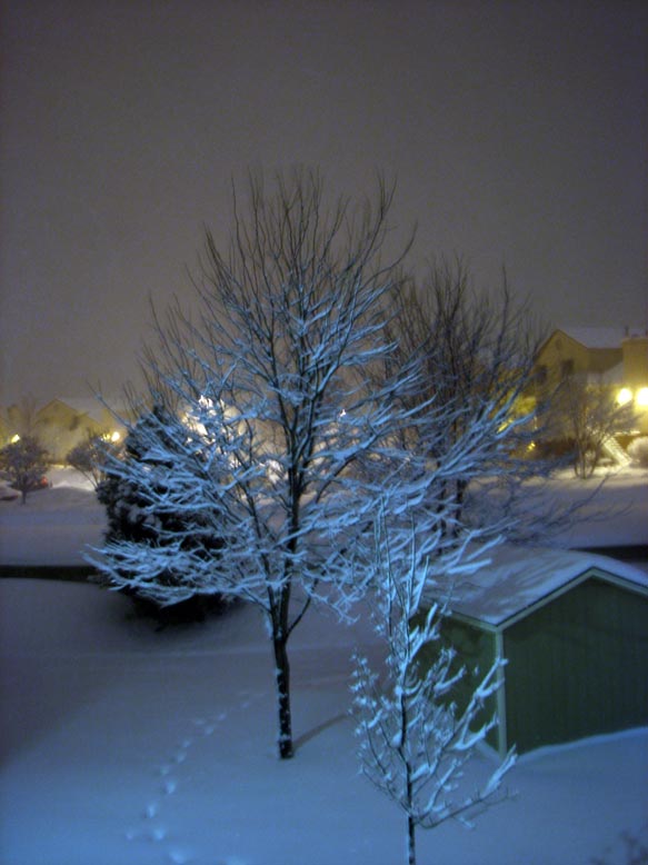
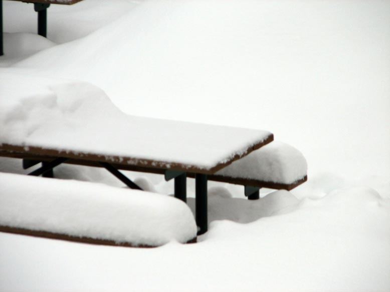
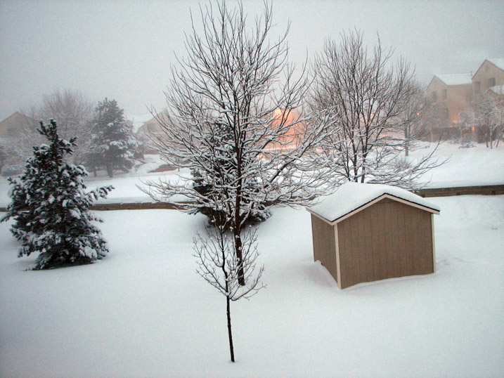
This is the view of the I-House backyard, taken from my porch
at 8:19 PM. I am using the nearest picnic table as my snowboard for taking new
snow measurements. The large mound is a snowcave that someone built from last
week's storm. By now, you can tell that several inches of snow have fallen.
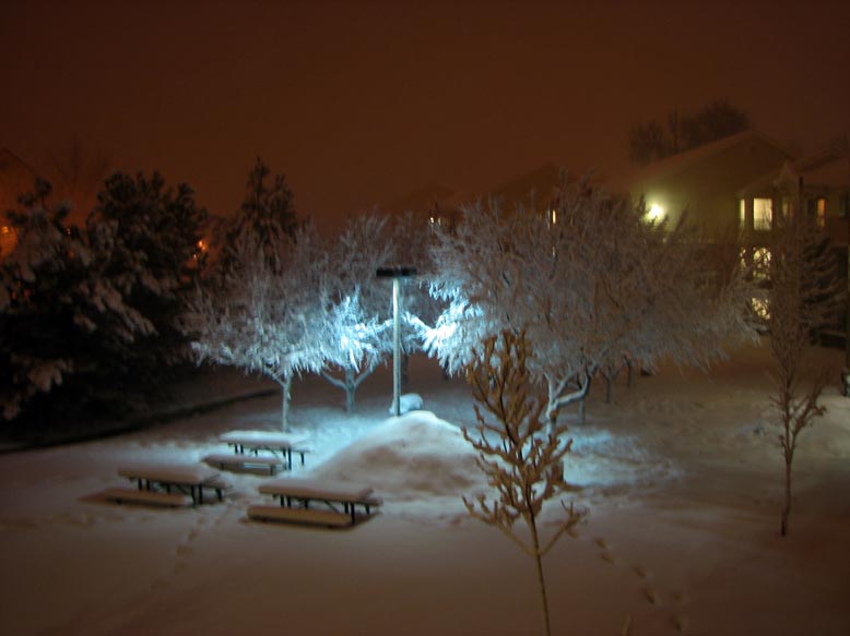
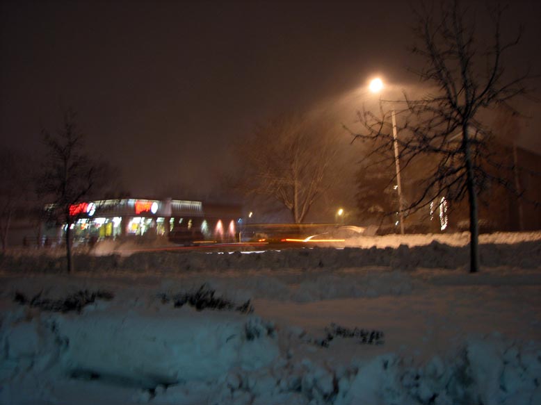
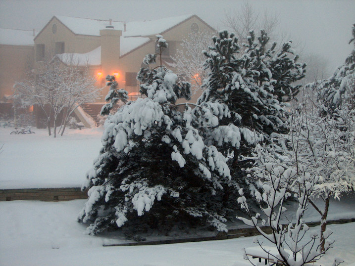
Here is the view at 9:32 PM. In the last hour, the snow has
gotten considerably deeper. The trees are now totally coated with snow - this is
partly because it rained before it switched to snow so the snow stuck well. But
it is also due to the fact that the snow was very sticky at first.
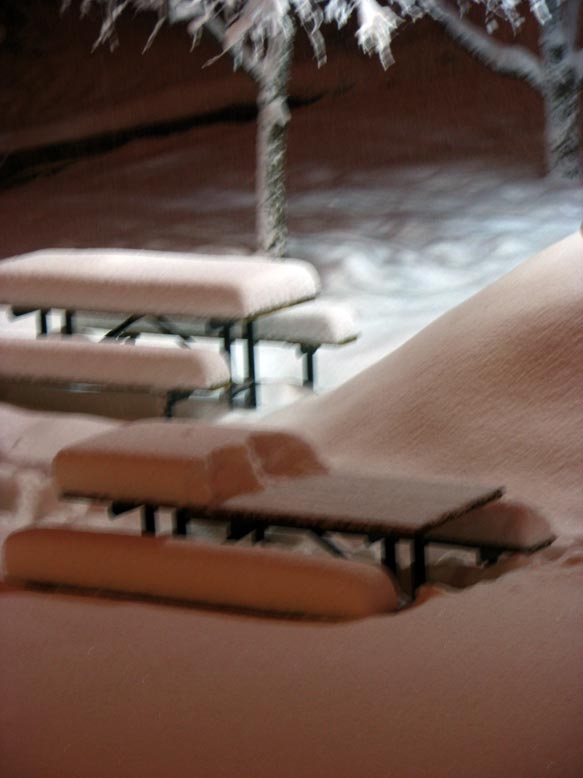
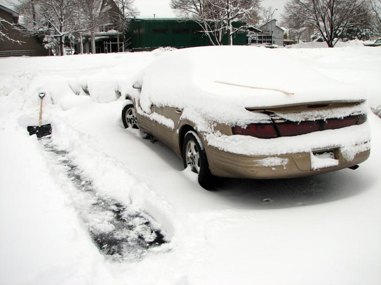
This is the view at 10:16 PM, just a few minutes after I
measured 7.7" of snow so far.
Posted
Noon, Friday, Dec 29, 2006
I woke up around 7:30 this morning to a winter wonderland.
Last night's heavy snow stuck to the tree branches just as any proper snowstorm
should :) The first wave was basically over when I went to bed last night,
so there was hardly any new accumulation. At 10:10 AM, I measured 0.8" of new
snow, bringing the storm total to 8.5". The snowdepth was still 18", as the snow
probably settled a bit overnight. I went out for a 5-mile run earlier, and
surprisingly the streets seem quite passable - if you can get out of your
parking spot! CSU snow removal teams had already plowed the sidewalks around the
I-House, but a thin veneer of ice was left, so it was very slick. I ran through
neighborhoods down to the Spring Creek Trail - City Park Avenue had been plowed,
as had some of the residential streets. This is a nice change of policy -
typically residential streets in Fort Collins are rarely plowed, but the reasons
are good fodder for a separate blog entry. Anyway, a few cars were driving about
on West Elizabeth, so the overnight snow did not deal a crippling blow to the
city. We ended up on the low end of the NWS predictions (8-18") for that period,
so this just restores the snowpack to close to what it was after the last storm.
With all the melting and hard snow removal work of the past week, it appears
that if it doesn't snow much more, life will return to normal fairly quickly.
Archived Snowfall Totals for
Northeast Colorado as of 10 AM
So far, the highest snowfall total seems to be 29.4" in
Coal Creek Canyon. This is certainly impressive and is in line with what the NWS
was forecasting for a max in the Foothills. And of course, this is also on top
of last week's 30-40"!
So now - what of the future? Is the storm finished or is a
second wave about to blast us?
Here is what the NWS was saying this morning (as of about 6 AM):
SNOW WILL CONTINUE THROUGH TONIGHT & WILL BE HEAVY AT TIMES. ESPECIALLY THIS
MORNING. ADDITIONAL SNOW ACCUMULATIONS OF 6 TO 14 INCHES CAN BE EXPECTED THROUGH
TONIGHT. WITH THE HEAVIEST AMOUNTS IN THE WESTERN & S. PARTS OF THE DENVER METRO
AREA. THIS WILL BRING STORM TOTAL SNOWFALL INTO THE RANGE OF 15 TO 30 INCHES.
NO. WINDS OF 15 TO 25 MPH WITH GUSTS TO 35 MPH WILL PRODUCE LOW VISIBILITIES IN
BLOWING & DRIFTING SNOW.
THERE IS A POTENTIAL FOR ADDITIONAL HEAVY SNOWFALL & STRONG WINDS SAT THROUGH
SUN AS THE STORM CONTINUES TO MOVE SLOWLY NORTHEASTWARD. ADDITIONAL SNOWFALL
ACCUMULATIONS OF 6 TO 12 INCHES WILL BE POSSIBLE ALONG WITH AREAS OF BLOWING AND
DRIFTING SNOW.
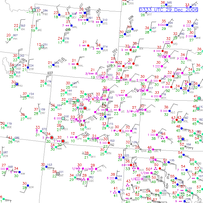
The regional radar composite (at 8:48 AM MST, Dec 29, 2006)
showed another slug of moisture coming up from the south. However, as time
progressed, the bands seemed to be dissipating by the time they got to Fort
Collins. This is likely because there is no longer any deep upslope to support
them. So the Eastern Plains are getting hammered with blizzard conditions, and
Fort Collins will is just getting an occasional flurry.
Now (as of about 11:28 AM) the NWS has cancelled the
Winter Storm Warning and put a Snow and Blowing Snow Advisory into effect
through tonight. They say 2-6" are possible today, especially east and south of
Denver. So Fort Collins will likely get continued flurries. They are still not
certain about whether heavier snow will backwash into the Front Range on
Saturday and Sunday, so a Winter Storm Watch is now in effect through Sunday
afternoon with the potential for 6-12" (if it actually verifies, that
would make this a 3-day storm!).
I'm guessing that the storm is pretty much done, but I
could be wrong. I never bothered to put snow cables on my car last night, but I
did shovel out my car this morning. In fact, I shoveled a complete parking
space, then moved my car to that space and shoveled out around where it had been
parked, so now I have two free spaces. So if I do need to go anywhere, at least
I'm ready :)
Now I'll review the current meteorological situation:
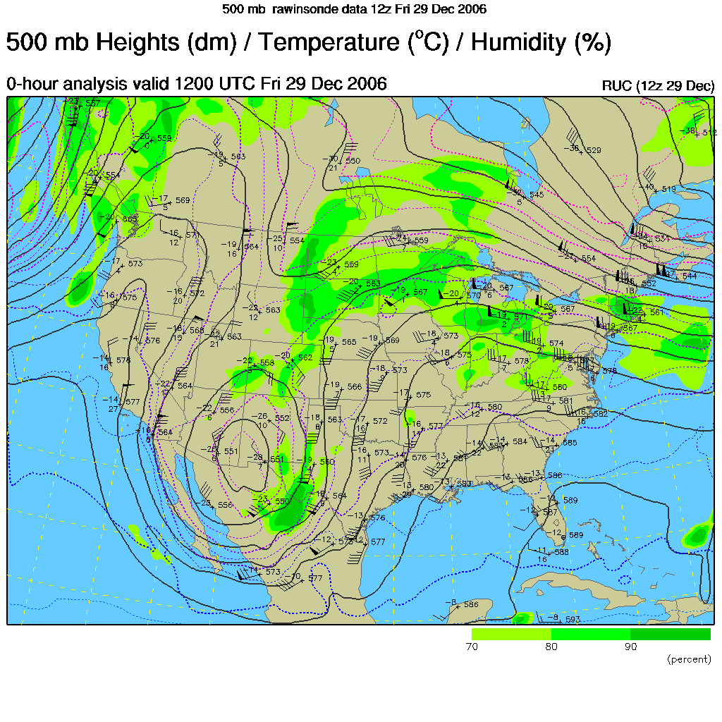
This morning's (12Z Dec 29, 2006) 500 mb map shows that the
upper low has barely moved. If anything, it has sunk further south. This is not
good for more snow here, but it is excellent for northeast NM and southeast CO.
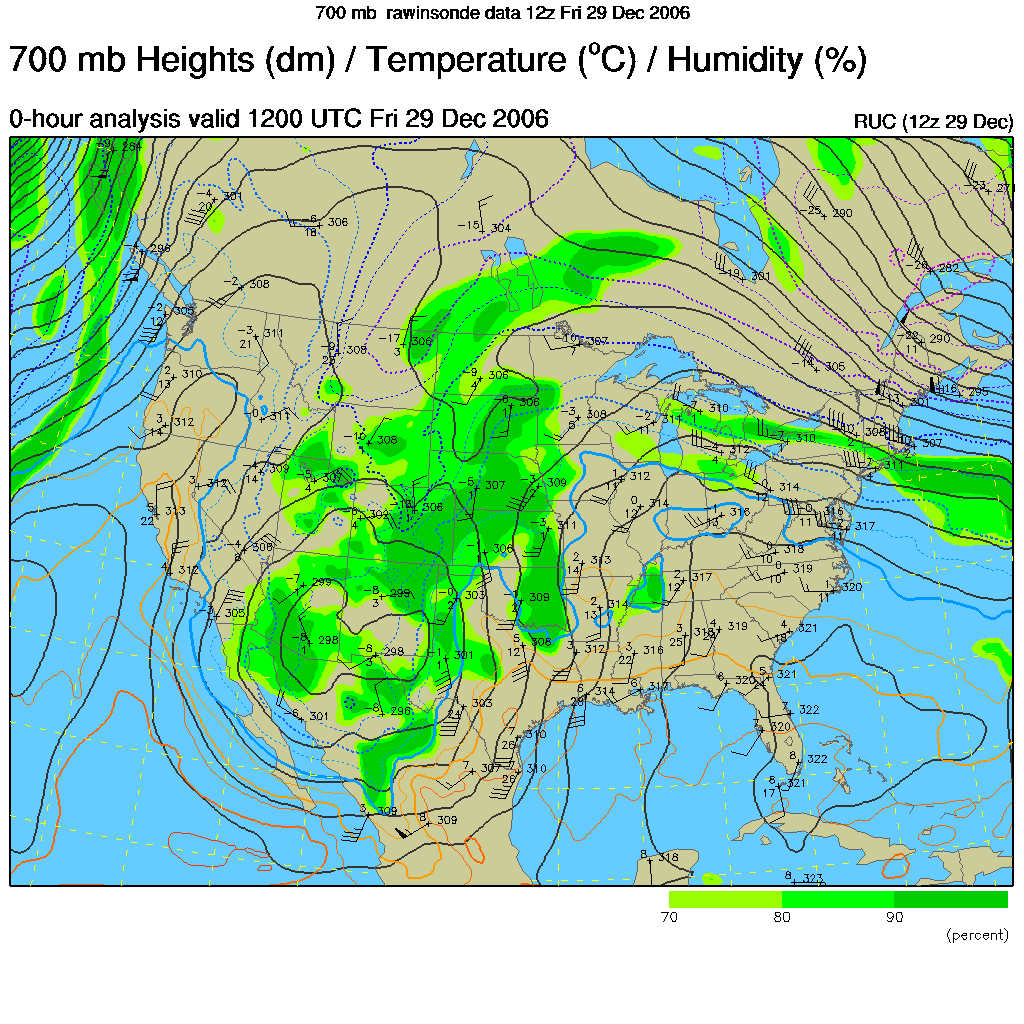
The 700 mb map shows a scene similar to last night - a very broad and somewhat
diffuse low pressure system. The eastern side of the circulation continues to
advect very warm and moist air up through TX and KS, supporting heavy rain and
convection there. But the flow is just not strong enough right now to bring it
all the way into the Front Range. A ridge extends down right along the Front
Range, while an inverted trough extends through NE Colorado - most of the
precipitation is happening out there.
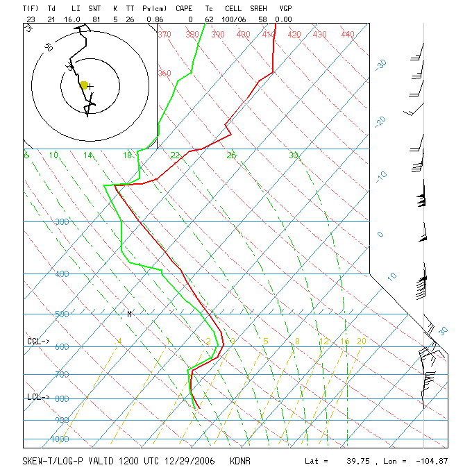
This morning's Denver sounding is quite different than last night. Now it is
only saturated to about 500 mb and there is little upslope component at the
lower levels. Also, it has gotten quite a bit colder in the lower levels -
reflective of the continued cold air advection in the ridge of high pressure
that is nosing down just east of the Front Range.
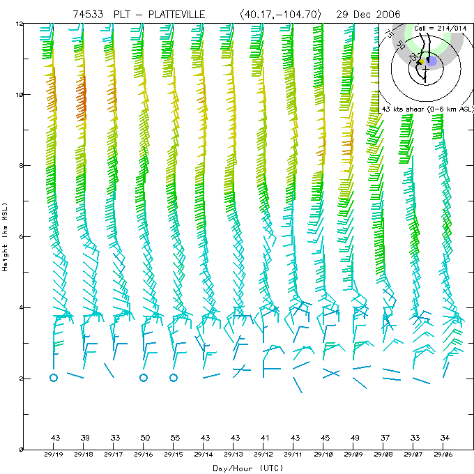
Unfortunately, I didn't save last night's Platteville wind sounding, and this
one (as of about Noon today) only extends back to the period when the upslope
was just ending (and the snow was ending as well).
Posted 4:30 PM, Friday, Dec 29, 2006
There hasn't been any snow of note since late last night,
so it's been a rather quiet and boring day. CSU was closed today because of the
snow, so I've
just been enjoying the day at home. I think I'm about blogged out at the moment
though. I'm going to post my pictures a little later tonight, but here are the snow totals. If nothing
else happens, I might write one more wrap-up and post some video (my best guess
is that we'll get 2-3" of snow tomorrow and then that might be it). Anyway, it's
been a fun storm. I hope you enjoyed my first snow blog :) Maybe I jinxed
this storm by keeping too close of a watch on it.
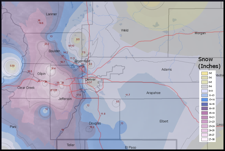
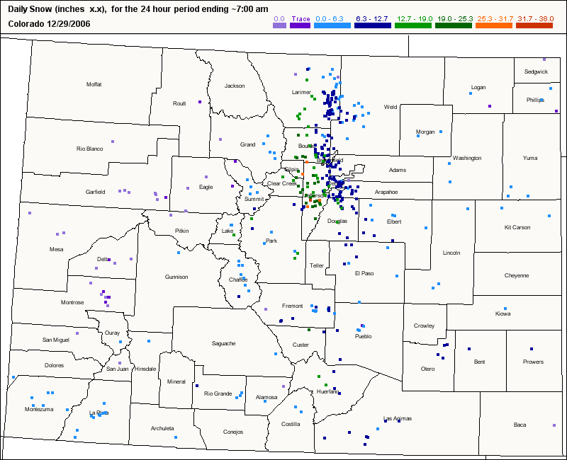
Here is a map of the snow spotter reports through the first
part of the storm (about Noon, Friday, Dec 29, 2006) - courtesy of the National
Weather Service. The Foothills have gotten the most by far, with several places
close to 30". (NOTE, the NWS has updated their maps - see the entry on Jan
4 for the final version).
Here's a statewide view of today's CoCoRAHS snowfall reports.
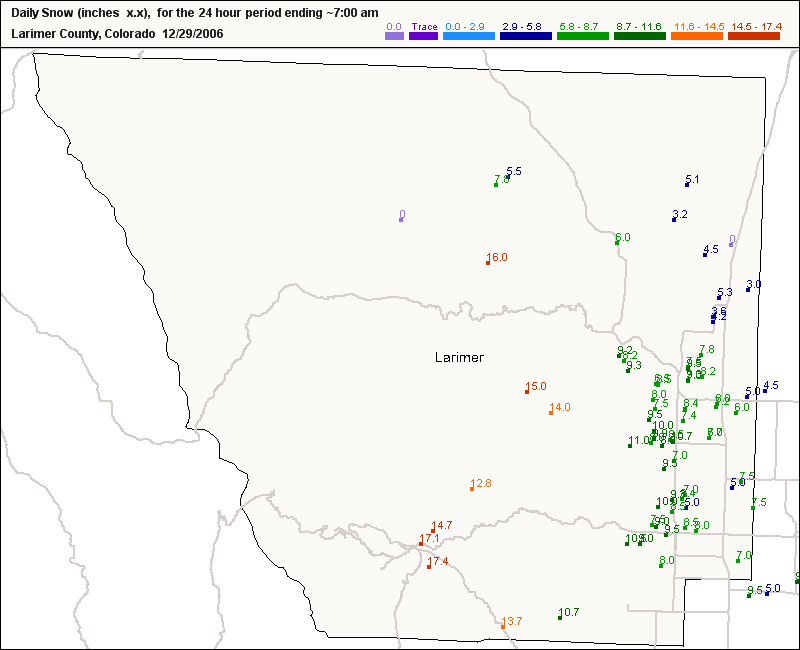
Here are the reports from Larimer County.
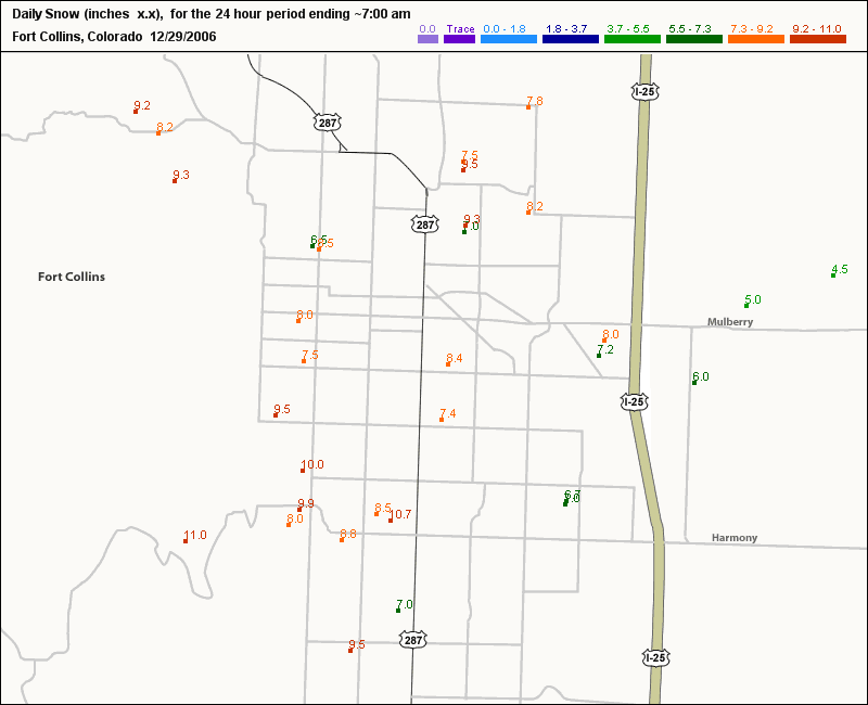
... and Fort Collins.
[Here are some updated statistics about the storm from Denver's
perspective - this is from the Denver NWS web page.]
December 2006 Has Now Moved Into 3rd Most Snowiest Denver December
The latest winter storm (December 28th-29th
2006), which is a
second separate winter storm, has officially dumped 7.0 inches at the
former Stapleton International Airport. This amount is measured by COOP
weather observers and their snow depth is measured at 6AM. This total of
7.0 inches has moved December 2006 into 3rd snowiest Denver December in
Denver weather history with a total of 28.4 inches. The most snow ever
recorded in Denver during December is 57.4 inches recorded in 1913.
December 1913 is also the snowiest month in Denver weather history. (Note:
These 2 recent
winter storms are separate storms and cannot be added together to count as
one single storm because they are one week apart and therefore the December
20-21 storm will still remain in 7th strongest winter storm in Denver
weather history)
The December 20-21
Winter Storm officially measured 20.7
inches at the former Stapleton International
Airport. This puts this winter storm in 7th position
in strongest winter storms in Denver Weather History since 1946. See
the table below for the Top 12 Denver Snowstorms since 1946.
Denver’s Snowstorm
Total Snowfall Statistics
|
Greatest Amount Of Snowfall Over 5 Days:
45.7 inches intermittently from December 1-5, 1913
(37.6 inches of continuous snowfall
(40 hours) recorded between December 4-5th) |
| The Top 12 Denver Snowstorms since 1946: |
31.8 inches Mar 18, 2003
30.4 inches Nov 3, 1946
23.8 inches Dec 24, 1982
21.9 inches Oct 25, 1997
21.5 inches Nov 27, 1983
21.2 inches Nov 19, 1991
20.7 inches Dec 21, 2006
18.7 inches Mar 5, 1983
17.7 inches Nov 19, 1979
17.3 inches Apr 1, 1957
16.9 inches Mar 20, 1952
16.0 inches Oct 3, 1969 |
Posted 9:00 PM, Friday, Dec 29, 2006
The latest word from the NWS is that the second wave
has been cancelled - at least for Fort Collins. It now seems more certain
that the brunt of the storm will hammer the Eastern Plains of Colorado but
leave the Front Range relatively untouched. We might get a little light snow
and wind tomorrow, but that should be about it. So in the end, this wasn't
the remarkable storm that it could have been, but it was still significant,
especially coming on the heels of last week's blizzard. The combined
snowfall from both storms was about 28"!
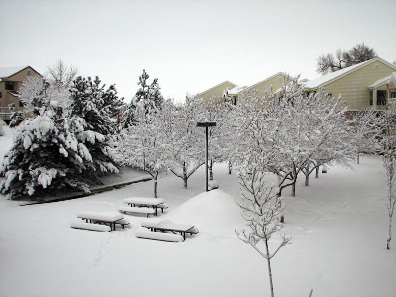
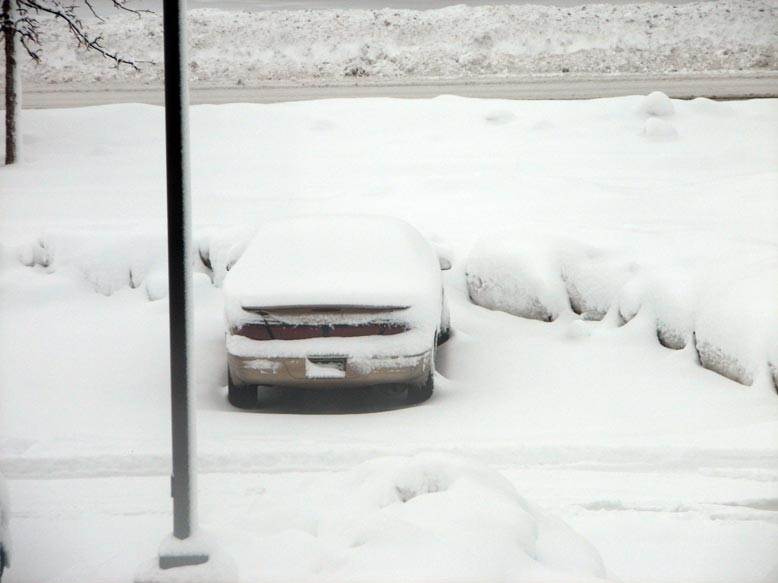
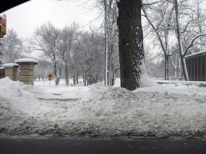
Here are some more pictures of the winter wonderland I
woke up to this morning.
This is how much snow fell last night after my 10:05 PM measurement - only 0.8".
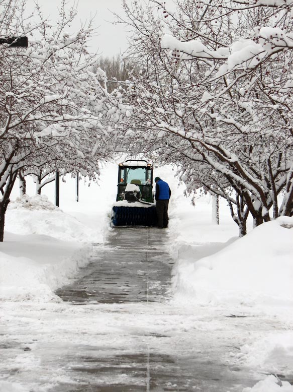
CSU is really good about plowing the sidewalks . . .
. . . but not so good about plowing the parking lots.
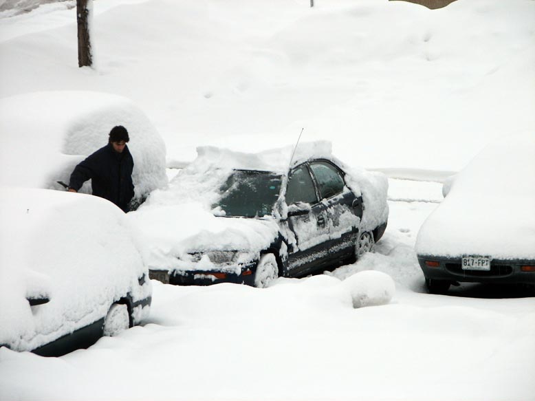
Here's my car - it looks like digging out a parking spot won't be as bad this
time.
Beginning to dig a parking spot . . .
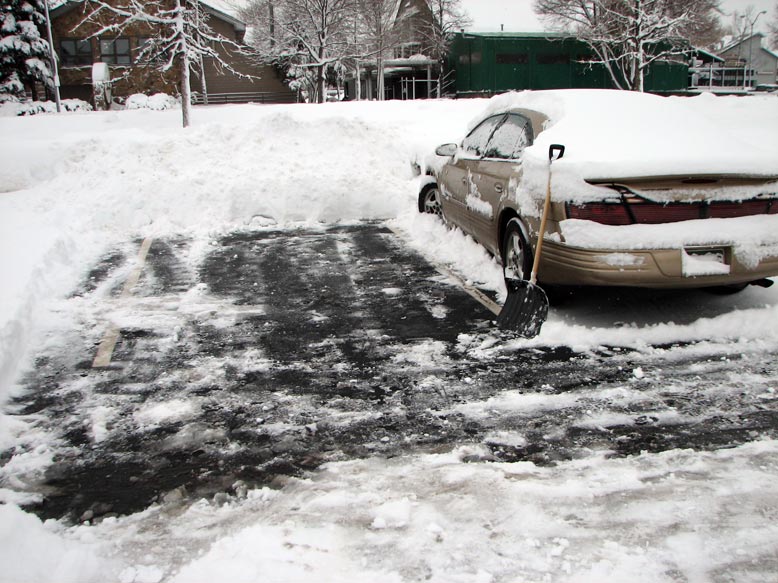
It still took about 15 min, but it wasn't that difficult. For good measure, I
cleared an extra space.
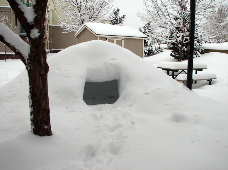
The snow cave that someone built form last week's storm is getting buried!
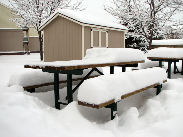
The top of the picnic table was clear at the beginning of this storm.
18" of snow on the ground! There was 12" on the ground when the storm began.
Posted
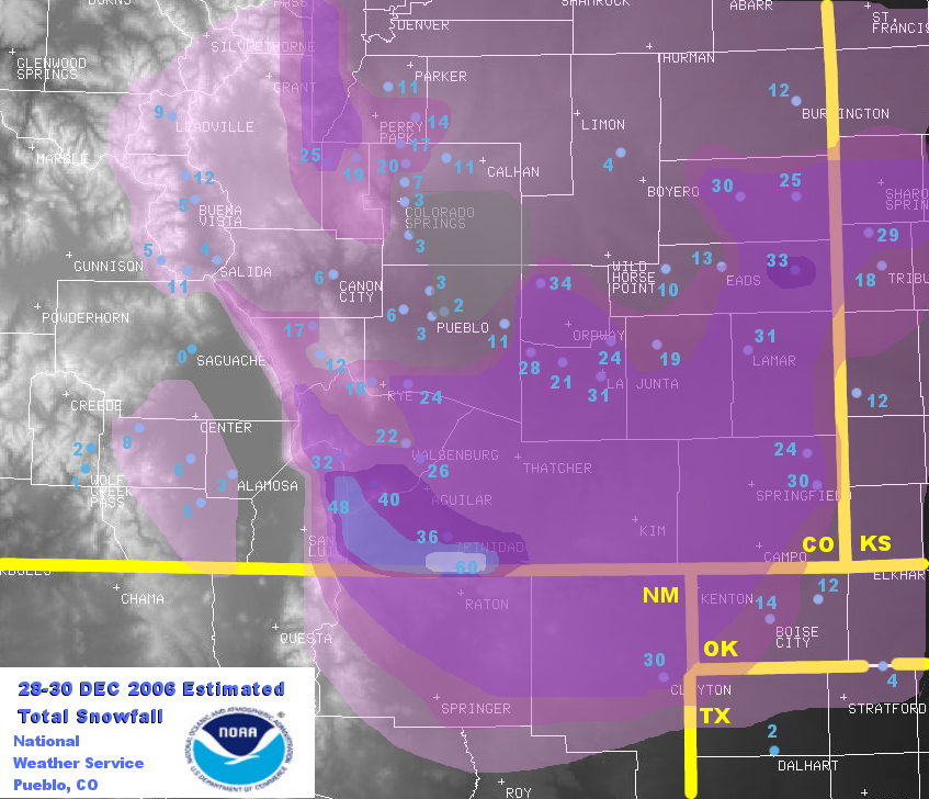
10:00 PM, Thursday, Jan 4, 2007
I took some more pictures of the storm aftermath as I drove
around in Fort Collins over the weekend, so I'm making another entry on this now
very long snow blog. Also, the NWS updated their maps for both storms, so I'm
adding this for posterity's sake. In retrospect, the 2nd storm was mostly a dud
here in Fort Collins and not really that spectacular for the rest of the Urban
Corridor, but it will hold it's place in history - namely for the awesome
impacts that it had on SE Colorado, SW Kansas, and NE New Mexico. Some areas of
Kansas and SE Colorado had upwards of 30-35" during the 2nd storm. The far
southern mountains of Colorado had up to 4 feet and an area near the Raton Mesa
had a total of 60"! Needless to say, for the second time in 10 days, large
sections of the surface transportation network. Practically all routes south and
east of Colorado were shut for several days. A major effort is underway to help
save tens of thousands of head of cattle which have been trapped by snowdrifts
up to 18 feet high! Helicopters from across the region are being used to airlift
hay to the areas where cattle are, and people are also using sledgehammers to
break through the ice on creeks so the cattle can drink. It is not a fun time to
be a cow in SE Colorado.
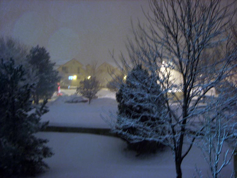
This is the view out from my porch on Saturday morning, Dec 30. I bet a lot of
people in Fort Collins probably woke up hoping the snow had mysteriously
vanished during the night. No such luck. An eerie fog blanketed the area.
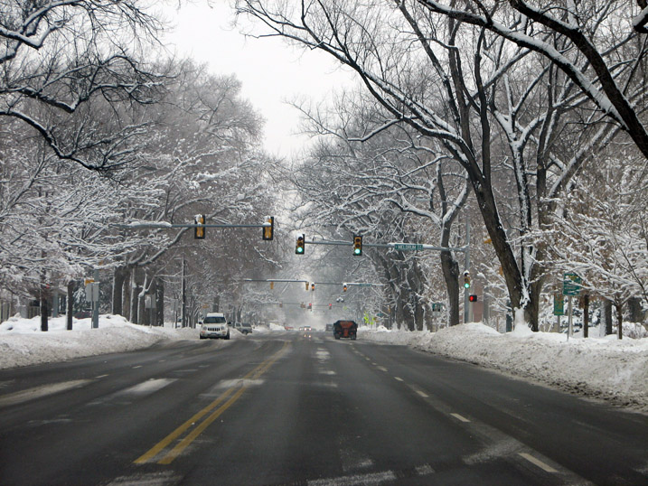
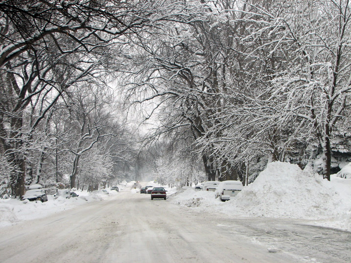
Here is the view on Laurel Street less than 36 hrs after the storm had ended. As
you can see, the snow removal efforts were decent after this storm.
There is the Danforth Chapel, on the NW side of CSU's Oval Drive.
Here is another view looking down the tree-lined walkway in the Oval.
Here is the view looking west onto the CSU campus from College Avenue.
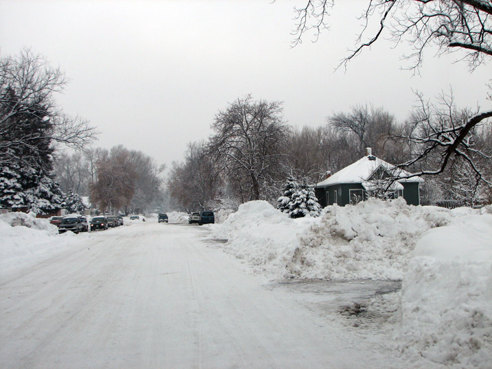
As I turned onto the side streets, the situation looked less optimistic. Indeed,
Fort Collins looks a bit like I would imagine Narnia might have looked like when
under the Witch's winter spell.
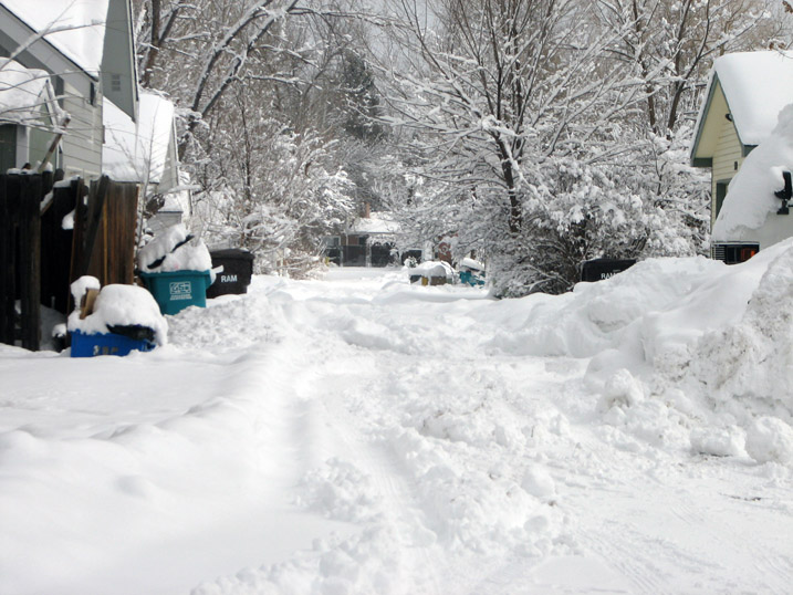
Some people live off of alleys - a rather dubious journey for anyone not owning
a 4WD vehicle with high clearance.
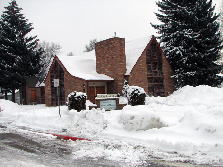
Here is how my church looked after the storm (corner of Pitkin and Wheedbe).
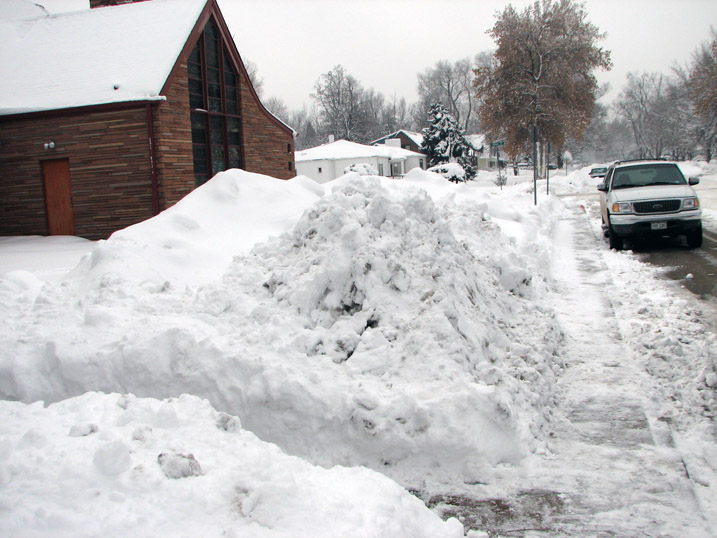
Several of our deacons own hefty equipment which came in very handy this week -
they cleared all the snow form the parking lot and piled it onto the church
lawn. Needless to say, this snow might be here for a while (June?).
Another view looking down Whedbee.
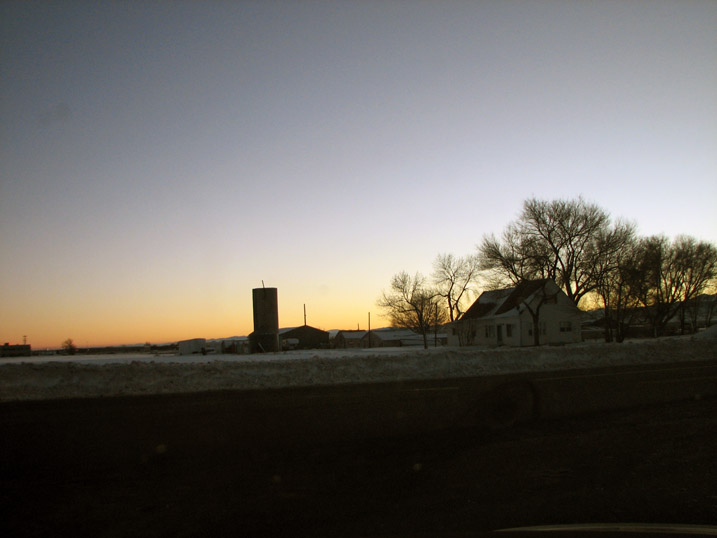
There was a nice sunset Saturdaynight - here is the view from the NE side of
town looking SE.
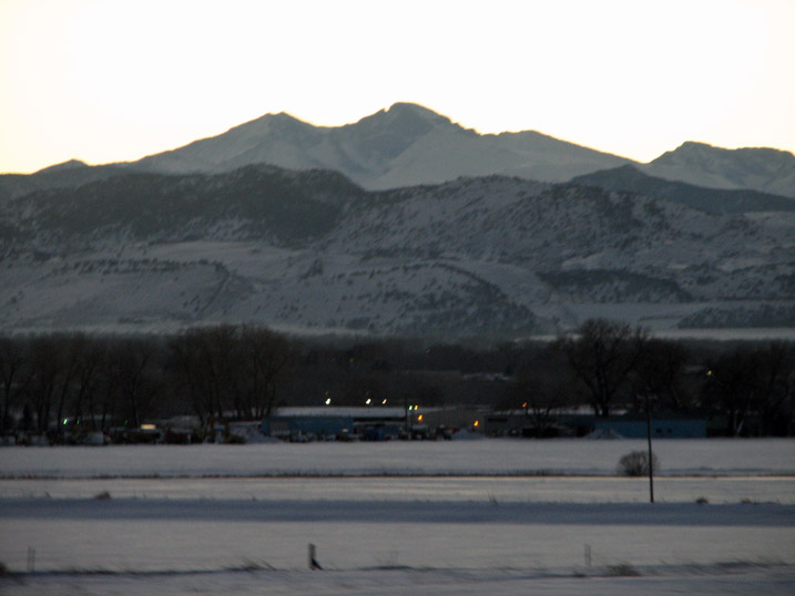
Here is a zoomed view of Longs Peak.
[Here are the final storm statistics from the Denver NWS web page.]
THE DECEMBER WINTER STORMS
DECEMBER 20-21 AND
DECEMBER 28-30 |
| After
reviewing more reports form both winter storm #1 and
winter storm #2, updated maps in a new format were
created. These maps show actual snowfall amounts.
the snowfall amounts are then contoured to give the
maps a more accurate view of what fell where. There
were many reports received and as always, the NWS
office here in Boulder thanks the efforts of each
and every one of the weather spotters who sent their
reports to us. Some of the spotters did not even
take time to sleep, they just kept keeping us
updated with their latest snowfall amounts. |
Here is the map for the
first storm that covered the period
December 20-21.
It was the strongest of the 2 storms
.
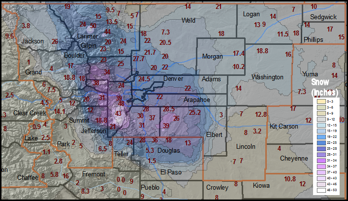
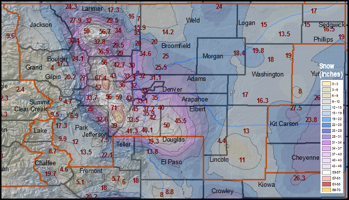
Here is
the map for the second storm that covered the period
December 28-30.
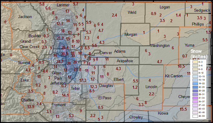
| And
finally,
it was interesting to look at a map that combined
BOTH storms. Remember, since these 2 storms
were a week apart, they still have to be treated as
separate storms. But, if they had occurred together,
the below map displays what the totals would look
like graphically. |
|
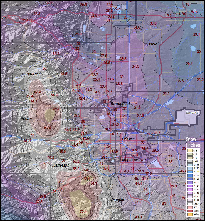
The combined two storm map is zoomed in over the
Denver Metro Area in graphic display below.
Remember, since these 2 storms were a week apart,
they still have to be treated as separate storms.
But, if they had occurred together, the below map
displays what the totals would have looked like
graphically. |
|
|